Classification of road roughness in mobile mapping data
| Leitung: | Feng, Feuerhake |
| Team: | Wenjun Xie |
| Jahr: | 2020 |
| Ist abgeschlossen: | ja |
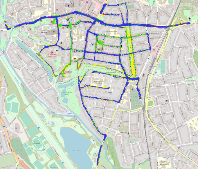
Different road surface has different roughness, which is a very important feature for flood simulation, roads maintenance and driving safety assessment. This study aims to classify between different road types based on road roughness using mobile mapping data. The input data is LiDAR point cloud after ground removal. Road surfaces are defined as asphalt, cobblestone, grass area and road boundary four categories. The roughness descriptor is generated using multiple local geometric features and distance histogram. Random forest is used to train a classifier and weighted random forest is used to deal with the imbalanced data problem. To make the result smoother and more consistent, conditional random field is applied to process the predicted results. Finally, all tiles are merged and rasterized into 25cm grids to generate a road surface map. The result accuracy is 88.6% on training dataset and 84.7% on test dataset. The model results are validated on a large area where the overall accuracy is 82.9%.


