Data Science - Big Data and Machine Learning
-
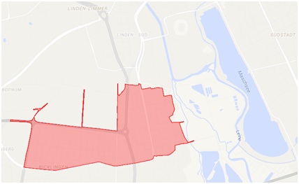
AgrImOnIA: The impact of agriculture on air quality and the COVID-19 pandemicAgrImOnIA is the project short name, being the acronym of Agricultural Impact On Italian Air. Also, Agrimonia eupatoria or Common agrimony is a plant and a flower spread in Alpine, Mediterranean and Central Europe, which is the positive symbol of this project. Lombardy has about 10 Million inhabitants and is the first Italian region for agriculture production. Bovines are about 1.5 Million and swine are about 4 Million. On average, there is a swine every 2.5 inhabitants and a bovine every 6.7 inhabitants. Considering that agriculture land is 69% of the region, there are about 245 swine and 92 bovines per rural km2. There is a large scientific consensus on the fact that livestock and fertilizers are responsible for about 95% of the ammonia emissions. After some reactions in the atmosphere, ammonia mainly turns to fine particulate matters known as PM2.5. Since PM2.5 is quite stable in the atmosphere, due to the limited air circulation in the Po Valley, the air quality is often affected by high concentrations of such pollutants. Adding the contributions of vehicle traffic and house heating, the plain of Lombardy is one of the most polluted areas in Europe. As a result, epidemiological studies found Lombardy to be the region with the highest PM2.5-related mortality rate: 164 deaths per 100 thousand inhabitants.Team:Year: 2021Funding: Cariplo Foundation (European Project)
-
Detection of structural breaks in stochastic processes with spatial dependenciesWith growing availability of high-resolution spatial data, like high-definition images, 3d point clouds of LIDAR scanners, or communication and sensor networks, it might become challenging to timely detect changes and simultaneously account for spatial interactions. To detect local changes in the mean of isotropic spatiotemporal processes with a locally constraint dependence structure, we propose a monitoring procedure, which can completely be run on parallel processors. This allows for a fast detection of local changes, i.e., only a few spatial locations are affected by the change. Due to parallel computation, high-frequency data could also be monitored. We, therefore, additionally focus on the processing time required to compute the control statistics.Led by: Prof. Dr. Philipp OttoYear: 2019
-
Statistical estimation of high-dimensional, spatial dependency structures using machine learning methodsThe project deals with an important, fundamental problem of spatial and spatiotemporal statistics – the full estimation of the underlying spatial dependence structure. For these models, the focus has so far been on processes showing a dependence in the conditional means. That is, the mean of a realization of the random process at a particular measurement point depends on the adjacent observations. This finding goes back to Tobler’s first law of Geography. The surrounding observations are defined on the basis of their geographical proximity, although this does not necessarily lead to a dependence of the observations of the random variables, i.e. the covariances. Various application examples will be used to demonstrate how the estimated parameters can be interpreted. Here, the focus will be on natural processes in the environment, such as air pollution or particulate matter. Using freely available sensor data, the results can be used, for example, to obtain local predictions of fine dust pollution in an urban area, which can then be used for optimal routing with respect to air quality.Led by: Prof. Dr. Philipp OttoYear: 2019Funding: Deutsche Forschungsgemeinschaft
-
Spatial and spatio-temporal GARCH modelsThe project is concerned with a subfield of spatial statistics, which deals in particular with the analysis of random processes in space. When analyzing such processes, it can often be found that observations that are located in spatial proximity to each other are similar. If, for example, land prices in a municipality are high, high prices can also be expected in the surrounding municipalities. In addition to this spatial dependency in the level of observations, a spatial dependency in the dispersion of observations as well as the conditional heteroskedasticity can also be determined. In the project, models for this will be developed and extended. The spatial models are analogous to the ARCH model of Robert F. Engle (1982) in time series analysis, who was awarded the Nobel Prize for Economics in 2003.Led by: Prof. Dr. Philipp OttoYear: 2019Funding: Deutsche Forschungsgemeinschaft
-
TransMIT - Resource-optimised transformation of combined and separate drainage systems in existing quarters with high settlement pressureIncreasing heavy rainfall events and growing urban districts pose great challenges for urban drainage. Using three neighbourhoods in the cities of Braunschweig, Hanover and Hildesheim as examples, it will be shown how urban development and water management aspects can be linked in the long term in neighbourhood planning.Led by: Dr.-Ing. M. Beier; Prof. S. Köster, ISAH; Prof. Sester, ikgTeam:Year: 2019
![]()
![]()
-
Object detection in airborne laser scanning (ALS) data using deep learningIn partnership with the Lower Saxony State Office for Preservation of Historic Monuments, we are developing a method for automatically detecting archaeological objects in airborne laser scanning data. The type of objects to be detected are mainly those of interest by archaeologists such as heaps, shafts, charcoal piles, pits, barrows, bomb craters, hollow ways, etc. They could be point, linear, or areal objects. To this end, we are using deep learning techniques; namely, convolutional neural networks (CNNs) to classify height images from the region of interest. A combination of multiple (in most cases 5) CNN classifiers are then used to detect and localize objects of interest in a digital terrain model acquired from the region of interest.Team:Year: 2018Funding: MWK Pro*Niedersachsen
![]()
![]()
-
Interdisciplinary Center for Applied Machine Learning - ICAMLThe ICAML (Interdisciplinary Center for Applied Machine Learning) aims at increasing the accessibility of machine learning across disciplines. Therefore, three fundamental components are developed and used.Team:Year: 2018Funding: Federal Ministry of Education and ResearchDuration: 11/2017-11/2019
-
USEfULDue to its location at the center of Europe and the global operating companies, logistics and mobility have always been of outstanding importance in Hanover, a city rebuilt car-friendly after the war. A growing city is associated with increasing mobility and supply needs as well as an individually and systemically caused need of logistics for supply and disposal.Team:Year: 2018Funding: BMBF: 03SF0547
![]()
![]()
-
3D object extraction of high-resolution 3D point cloudsNational Survey Departments acquire area-wide, controlled airborne laser scanning (ALS) datasets with different point densities, which are at least classified into ground and non-ground points. The Working Committee of the Surveying Authorities of the Laender of the Federal Republic of Germany (AdV) is discussing about an update cycle of 10 years for ALS point clouds. The national survey departments also acquire 3D point clouds from aerial images every 2-3 years with high overlapping ratios using a method called Dense Image Matching (DIM). Those DIM point clouds have a high point density, which is equal to the original aerial image resolution. In addition, those DIM point clouds also contain radiometric information from the aerial images, but only reconstruct the surface due to image correlation. This project is split into four distinctive topics.Led by: Sester, MonikaTeam:Year: 2017Funding: Forschungs- und Entwicklungsvorhaben zwischen den Landesvermessungsämtern Niedersachsen, Schleswig-Holstein und Mecklenburg-VorpommernDuration: seit 2017
![]()
![]()
-
Scene analysis - pattern recognition in person tracksThe project deals with the automatic recognition of conspicuous movement patterns from given trajectories as (x, y, t) sequences of objects. For this purpose, patterns are defined that indicate conspicuous behavior for which automatic extraction methods are to be researched. This includes, among others, the qualitative description of the recognition rates of patterns.Team:Year: 2017
![]()
![]()
-
Real Time Prediction of Pluvial Floods and Induced Water Contamination in Urban Areas (EVUS)This project aims at developing a fast forecast model for pluvial floods in the city of Hannover. The main goal of the subproject for ikg is to integrate new sensors for the flood prediction models.Team:Year: 2017Funding: BMBF Georisiken
![]()
![]()