Big Data and Machine Learning
-
TransMIT - Resource-optimised transformation of combined and separate drainage systems in existing quarters with high settlement pressureIncreasing heavy rainfall events and growing urban districts pose great challenges for urban drainage. Using three neighbourhoods in the cities of Braunschweig, Hanover and Hildesheim as examples, it will be shown how urban development and water management aspects can be linked in the long term in neighbourhood planning.Led by: Dr.-Ing. M. Beier; Prof. S. Köster, ISAH; Prof. Sester, ikgTeam:Year: 2019
![]()
![]()
-
USEfULDue to its location at the center of Europe and the global operating companies, logistics and mobility have always been of outstanding importance in Hanover, a city rebuilt car-friendly after the war. A growing city is associated with increasing mobility and supply needs as well as an individually and systemically caused need of logistics for supply and disposal.Team:Year: 2018Funding: BMBF: 03SF0547
![]()
![]()


Laser Scanning
-
Mobile Mapping BikeThe ikg Mobile Mapping Bike is a supplement to existing mobile mapping systems such as those used at the Institute of Cartography and Geoinformatics, which are traditionally mounted on a car or van. The cargo bike makes it possible to cover or develop remote, winding or inaccessible regions. But the Mobile Mapping Bike can also be used independently, not only to record the surroundings, but also to enrich various other measured values with georeferencing. It can also be used and reconfigured more easily for student projects, as no driving license is required and the software and hardware can be flexibly adapted.Led by: Schimansky, Wage, Golze, FeuerhakeYear: 2023Funding: InstitutsprojektDuration: fortlaufend
![MobileMappingBike]()
![MobileMappingBike]()
-
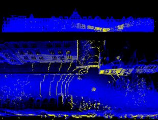
5GAPS - Lokalisierung“Lokalisierung von mobilen Objekten in 3D-Rasterdaten” Das Projekt 5GAPS entwickelt ein alternatives 5G-mobilfunkgestütztes, hochgenaues und um Eigenschaften erweitertes dynamisches Positionierungssystem auf Basis eines digitalen Zwillings des (halb)öffentlichen Raums in Form eines 3-D-Rasters und führt erste Proofs-of-Concept durch. Das Projekt wird mit verschiedenen Partnern aus Wissenschaft und Wirtschaft bearbeitet. Am Institut für Kartographie und Geoinformatik sollen dabei Aufgaben im Bereich der Erfassung, Verarbeitung und Visualisierung der hochdimensionalen Daten durchgeführt werden.Led by: Sester, MonikaTeam:Year: 2022Funding: Bundesministerium für Digitales und Verkehr, Förderkennzeichen: 45FGU121_EDuration: 2022-2024
![]()
![]()
-
TransMIT - Resource-optimised transformation of combined and separate drainage systems in existing quarters with high settlement pressureIncreasing heavy rainfall events and growing urban districts pose great challenges for urban drainage. Using three neighbourhoods in the cities of Braunschweig, Hanover and Hildesheim as examples, it will be shown how urban development and water management aspects can be linked in the long term in neighbourhood planning.Led by: Dr.-Ing. M. Beier; Prof. S. Köster, ISAH; Prof. Sester, ikgTeam:Year: 2019
![]()
![]()


Mobility
-
Mobile Mapping BikeThe ikg Mobile Mapping Bike is a supplement to existing mobile mapping systems such as those used at the Institute of Cartography and Geoinformatics, which are traditionally mounted on a car or van. The cargo bike makes it possible to cover or develop remote, winding or inaccessible regions. But the Mobile Mapping Bike can also be used independently, not only to record the surroundings, but also to enrich various other measured values with georeferencing. It can also be used and reconfigured more easily for student projects, as no driving license is required and the software and hardware can be flexibly adapted.Led by: Schimansky, Wage, Golze, FeuerhakeYear: 2023Funding: InstitutsprojektDuration: fortlaufend
![MobileMappingBike]()
![MobileMappingBike]()
-
5GAPS - Anwendung im Bereich Urbane LogisitkDas Projekt 5GAPS (Access to Public Spaces) entwickelt ein alternatives 5G-mobilfunkgestütztes, zeitlich dynamisches Positionierungssystem auf Basis eines digitalen Zwillings des öffentlichen und halböffentlichen Raums in Form eines dreidimensionalen Rasters. Am ikg werden die Themen 1) Lokalisierung innerhalb und mit Hilfe der 3D-Struktur 2) Visualisierung und Interaktion mit der 3D-Struktur 3) Anwendung der 3D-Struktur für die urbane Logistik bearbeitet.Led by: Sester, Monika; Feuerhake, UdoTeam:Year: 2022Funding: Bundesministerium für Digitales und Verkehr, Förderkennzeichen: 45FGU121_E
![]()
![]()
-
USEfULDue to its location at the center of Europe and the global operating companies, logistics and mobility have always been of outstanding importance in Hanover, a city rebuilt car-friendly after the war. A growing city is associated with increasing mobility and supply needs as well as an individually and systemically caused need of logistics for supply and disposal.Team:Year: 2018Funding: BMBF: 03SF0547
![]()
![]()

