Flood detection from satellite images using deep learning
| Led by: | Feng |
| Team: | Shumin Tang |
| Year: | 2019 |
| Is Finished: | yes |
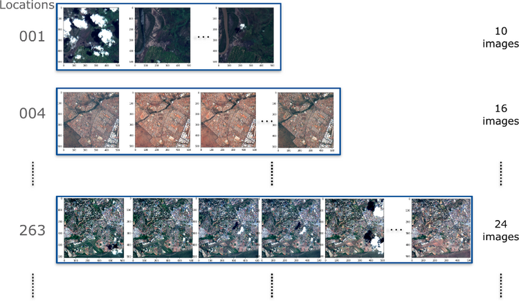
Floods destroy valuable resources and are one of the main threats to human life and property. Flood detection can protect lives and property by providing timely damage assessments. MediaEval is a benchmark that presents challenges in multimedia retrieval. In this thesis, methods were presented for the MediaEval 2019 task City-centered satellite sequences, which is aiming to detect flooding in time-based satellite image sequences. We proposed two Deep Learning methods that have been tried during the experiment – Siamese CNNs and CNN LSTM. By Siamese CNNs, a pair of images were put through two identical CNNs. The image pair was randomly chosen from one sequence. By CNN LSTM, CNN first extracts depth features from each individual image of the sequence. The sequential information among frame features is then learned through a LSTM network. This model is very suitable for learning image sequences. Experimental results showed that Siamese ResNet is not suitable for detecting flooding events from satellite image sequences, but the CNN LSTM could do this kind of task precisely. Significant high accuracy was achieved in flooding events recognition using the proposed DenseNet LSTM method on the MediaEval 2019 Satellite Task dataset.