Segmentation of Linear Terrain Structures in Digital Terrain Models Using Deep learning

| Led by: | Kazimi, Sester, Fidler |
| Team: | Heyue Zhang |
| Year: | 2020 |
| Is Finished: | yes |
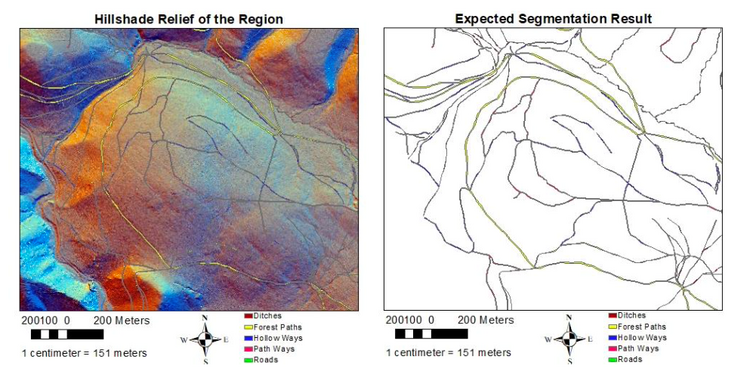
The archaeologists are interested in detecting terrain structures related to historical mining in the Harz Region. They could manually inspect regions of interest and find relevant terrain structures, but the task is time-consuming, so the goal of this thesis is to use deep learning techniques to automate this tedious task for archaeologists.
Linear feature is considered as one of the most essential terrain features, which can be representations of not only natural productions such as drainage networks or geological lineaments, but also manual parts including pipelines, road networks, and so on. The previous studies mainly utilized different computer vision techniques to detect the linear terrain structures, but it is not able to classify them. In our case, different neural networks are used to realize the semantic segmentation of our interested terrain structures which content hollow ways, pathways, roads, forest paths, and ditches. However, due to the complexity of identifying the linear structures, the segmentation result can be incomplete so that image processing algorithms are applied to refine the results.
In this thesis, three neural networks including UNet, CASENet and HRNet are implemented with two image processing algorithms including Region Growing and Hough Transform. After making predictions and optimizing, the evaluation result indicates that the HRNet with Region Growing performs the best result on the input hillshade relief of the region.
Keywords: linear terrain structures; edge detection; line connection; deep learning; line identifying; UNet; CASENet; HRNet; Region Growing; Hough Transform
